Thursday, February 23, 2012

Pining for the Fjords

We’re back in Queenstown for Entrepreneur’s Organization University, the “real” reason we’re in NZ, and we’ve seen some amazing things since our last post.
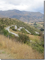
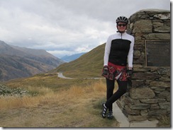
It was a tough trip to Queenstown from Wanaka. We went over the Crown Range, the highest paved road in NZ. Fortunately, we were going the easy direction. Though that still meant we had a 40 km climb, that got much steeper at the top. I had to get off and push for the last kilometer and Pancho for the last 500m. I was moving so slowly I was about to fall over, which on a super narrow road with no shoulder would surely mean getting run down by a campervan full of tourists. Of course, going up the easy side meant a screaming descent on the other side. You know it’s bad when you can smell your brakes burning out. We rewarded ourselves with lunch and cider in Arrowtown, an historic mining town on the outskirts of Queenstown.
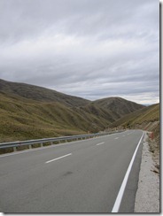
1214 Up the Crown
The road we rode up...
1216 Top of the Crown
At the top of the Crown Range
1220 Descent to Arrowtown
The road ahead. Check your brakes now!


We woke up in our tent in Queenstown to rain, cold, and unbelievably sore legs. This prompted a little conference regarding the cycling plan and led to the formulation of plan B.
We hopped on the bus to Te Anau, the gateway to Fiordland National Park, one of the most spectacular and remote areas in NZ. We had originally planned to cycle there, but then came plan B. It would have been two very long days on the bike, and our intel revealed that there would be a serious headwind for most of the way. Once we were on the bus, we were very pleased with plan B: the route was much hillier than we had thought and the even the bus struggled through the stiff winds. The only drawback for me was that we had planned to camp on an alpaca farm along the way, and I was weirdly excited about it. Fortunately, I made up for the wildlife viewing the next day.
Te Anau is a backpacker’s haven. It’s the starting point for several of the “Great Walks,” as they call some of the iconic hiking trails here, including the most famous of all, the Milford Track. (Trails are tracks; hiking is tramping) We felt right at home, with everyone walking around in boots, with packs and gear, either heading out or just coming in from the trail. There is also a big grocery store (not common in most of the smaller towns here) that is re-supply central.
Instead of hiking, on this trip we were on the water, going kayaking on Milford Sound, one of the most beautiful places in the country. The Fiordland NP has 16 sounds, with Milford being the only one accessible by road. There are a fair number of small cruise boats and tour boats there, but paddling is definitely the best way to see the sound. Technically, the sounds are all fjords, a sound being a river valley filled in by seawater and a fjord being a glacial valley. Apparently, the Kiwis compensated for the mistake by naming the Park properly, though they then misspelled it.
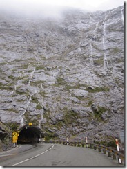
1254 Homer Tunnel 1
The Homer Tunnel, en route to
Milford Sound.
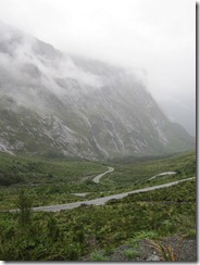
1256 Road from Homer Tunnel
The road down from the Homer Tunnel.


Nomenclature aside, the Sound is spectacular. We paddled through an area only accessible to kayaks at high tide that was like entering a primordial forest. There were branches hanging down across the water, covered with moss and orchids. Afterwards, we headed out into the Sound proper. The day started out rainy, which is a mixed blessing at Milford. The water was flat and perfect for paddling, But best of all, there were waterfalls everywhere. The Sound is surrounded by sheer mountains, and after rain, water pours down the rock faces, so there are streams of all sizes cascading down all around you.
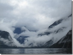
1261 Milford 4
Milford Sound.
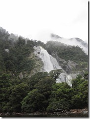
1263 Bolan Falls 2
Bowen Falls, the largest permanent
waterfall at Milford Sound.
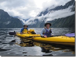
1277 Pancho and Nachita Paddle 2
Pancho and Nachita on the water.
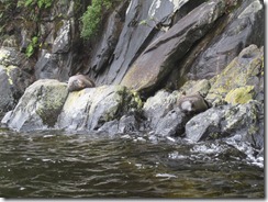
I also got in my wildlife quota to make up for missing the alpacas. Lots of young male seals live in the Sound, before they’re able to compete for the females in the colonies out on the coast. In the kayaks, we were able to get really close and just sit watching them. Now, we also know that there are animals lazier than our cats.
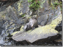
1265 Milford Seal 2
Milford seal.
1273 Milford Seal 10
Lazy beasts.


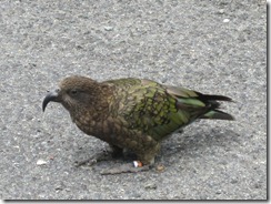
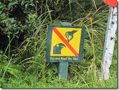
We had another wildlife encounter on the ride back to Te Anau—with the notorious kea, the naughty parrot of the South Island. We stopped at The Chasm, a river channel with amazing rock formations, and found a kea patrolling the parking lot, looking for snacks or cars to eat. Apparently, rental car agreements here contain a clause denying responsibility for kea damage. Yikes!
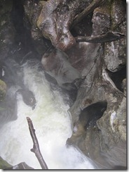
1290 Into the Chasm
Looking down into the Chasm. Off
the Milford Road.
1282 Kea 4
Naughty parrot.
1284 Kea Warning 2
Don't feed the kea if you want to keep
your finger.


Now we’re happily ensconced at the hotel in Queenstown—it’s been raining all night and day, so we’re very happy to not be in the tent. There are some great events planned, and we will be braving the rain this afternoon for a ride on the Shotover Jet Boat. Keep following along!

Saturday, February 18, 2012

A Stiff Shot of Reality

Today, we admitted we bit off a bit more than we could chew on the cycling portion of our trip. It is exactly like our first week on the AT—we way over-estimated our miles. Not to mention the fact that here, there is so much to see, a photo-op around every curve, and pushing big miles every day doesn’t allow for many stops. We’re behind schedule already, since we only made it to Franz Josef today. So we’re hopping a bus tomorrow, heading for Wanaka, and a long, hilly ride into Queenstown on Saturday.
1180 Poerua River near HariHari
Poerua River, south of Hari Hari.
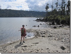
1185 Lake Wahapo
On the shore of Lake Wahapo, between Hari Hari and Franz Josef.
The ride today was spectacular, going through rainforest on the way to a glacier. It’s amazing how steep and heavily forested the mountains are. We rode through corridors of rainforest today (a return to the green tunnel), with towering trees covered with hanging bromeliads and steep slopes with gigantic ferns cascading down them. Then we would cross a broad, rocky riverbed, with a stream clearly coming down from the glacier. Now, we’re in the village of Franz Josef (disturbingly like a Kiwi-scale Gatlinburg), with the glacier hovering above us and rainforest all around. Surreal.
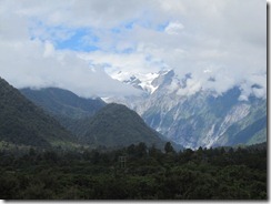
1189 Franz 1
Approaching the Franz Josef Glacier.
Fortunately, the scenery was astounding, because we moved into more hills today. I have to admit—we got our asses kicked today. It was just one of those days when we both felt totally out of gas, which is not good when you’re going over Mt. Hercules. On the plus side, we were at least traveling in the easy direction. But still. There were rest stops, There was bitching and moaning. There was Pancho shouting at me to leave him and save myself. Not our best day. So we’ll take tomorrow off, do some laundry, rest our legs, and start strong on Saturday. We’ll check in again when we get to Queenstown.

Tuesday, February 14, 2012

On the Road Again….

Saturday afternoon, we headed out on our next adventure—three action-packed weeks in New Zealand. Technically, we’re going to the Entrepreneur’s Organization conference in Queenstown, but that’s really only an excuse.
I was really dreading the flight: 5 hours to LAX, then 12+ to Auckland, then another short hop to Christchurch on the South Island. It turned out to be better than expected, but still a terribly long couple of days. One highlight of the trip was the Air New Zealand safety video. Now, we have long been fans of the Delta video, watching attentively while our friend Frank demonstrates proper seatbelt technique and Deltalina works her dominatrix mojo to stop smoking on-board. But I have to admit, Air New Zealand wins hands-down for the most wondrously wacky safety video. They have smoking hot All Blacks. They have body paint (consider yourself lucky, Frank!). But most importantly, they have Richard Simmons, in all his spastic, thinning afro, inappropriately short shorts, glory. Richard Simmons—epic!
We finally arrived in Christchurch and picked up our rental bikes and touring gear. After quickly reorganizing our enormous amounts of stuff, we set out for our B and B, in the central city. Of course, that was more adventurous than expected, since we were riding on the other side of the road and with loaded bikes for the first time. We made it without incident to the lovely Orari B and B. It was actually challenging to find lodging in Christchurch, since so many properties in the central city were destroyed or severely damaged by the earthquakes in 2010 and 2011. There is still a large section of the city cordoned off and inaccessible due to the instability of the buildings. We saw a number of beautiful, historic structures that have been irreparably damaged or will take years to repair. We didn’t see that much in Christchurch—we walked around the city center for a bit, then through the Botanical Gardens, which are truly spectacular. Unfortunately, we were too tired from the trip to really enjoy the city.
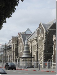
1066 ChrCh Turret
Turret in Christchuch earthquake zone.
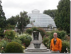
1077 ChrCh Conservatory Pancho
Christchurch Botanical Gardens Conservatory.
Currently closed due to earthquake damage.
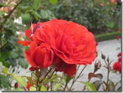
1078 ChrCh Rose
Christchurch Botanical Gardens.
The following morning, we set out in the rain to the train station to catch the Tranzscenic Alpine train across the South Island to Greymouth. This is considered one of the most spectacular train trips in the world. Unfortunately for us, it was a dreary, rainy day, so many of the mountains were obscured by clouds. It was still pretty spectacular, though, and I would highly recommend the journey. 
1115 Tranzalpine 18
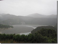
View from the Tranzalpine Train from
Christchurch to Greymouth.
1117 Tranzalpine 20
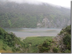
View from the Tranzalpine Train from
Christchurch to Greymouth.
1131 Tranzalpine Viaduct 4
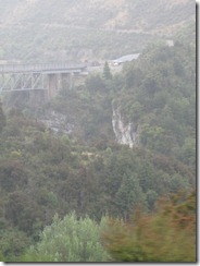
Viaduct on the Tranzalpine route between
Christchurch and Greymouth.
Once we arrived in Greymouth, it was time to hop on the bikes and head south to Queenstown. Fortunately, we started with an easy, flat, 40km pedal to Hokitika. For much of the ride, we were going along the coastline, watching the surf crash into the beach. We’re planning to camp for the biking section of the trip, so we headed to the Hokitika Holiday Park.
1163 Going to Hokitika
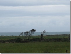
Coastal view between Greymouth and Hokitika.
1164 Hokitika Break
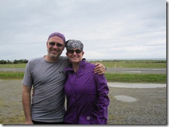
Taking a break en route to Hokitika.
1167 Hokitika Sign
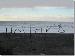
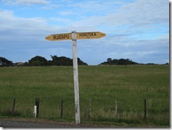
Hokitika beach sign.
It’s in many ways like being out on the trail again. There are loads of other cyclists touring here, and it’s great to meet other folks. Unfortunately, it’s also far too like the beginning of the hike. We feel like we’re starting over in so many ways—figuring out our systems, organizing our gear, adjusting to a very different physical activity. Today, we were supposed to go 134km to Franz Josef, one of the large glaciers here on the South Island. We didn’t quite make it, instead pulling up early in Hari Hari. We have a lot of pains today. Legs, butts, backs, you name it, it hurts. So now, we’re behind schedule, but we’ll figure something out. Happily, there is bus service all along our route to Queenstown, and we may have to avail ourselves of it. For the moment, we’re enjoying some local cider in the pub at the Hari Hari Motor Inn and I’m sure it will be an early evening. Much like the AT, 6:30PM is a perfectly acceptable time to go to bed.
1176 Road Sign
En route to Hari Hari.
1177 Pancho in Motion
Pancho on the move.

Thursday, February 9, 2012

Heads up!

Hey y'all! We're heading out again on Saturday, for New Zealand this time. We'll be cycling, caving (with glowworms!), hiking, sailing, and kayaking. We'll also be updating the blog to keep the Vicarious Living going. Check in. Keep up. Enjoy.