Wednesday, August 15, 2012

A Bit of Backtracking...


I know it has been quite a while. I am a bad, bad blogger. I'm making an effort to get back on the horse and start posting again on a regular basis. But that does demand a look backwards to some previous events.
Long ago, in New Zealand, I promised glowworms and caving photos. Well, the moment you have longed for has arrived--here are some pics from our adventure with the Legendary Blackwater Rafting Company. The most famous of the glowworm caves are located at Waitomo on the North Island.

A little rappelling practice before dropping into the cave.

Looking very perky on the way down....


We started out with a 105-ft. rappel into the cave.
Here goes Pancho.


After rappelling into the cave, we did a short zipline--IN THE DARK--to a ledge above the subterranean river. Wicked cool. On the ledge, we grabbed our innertubes, then launched ourselves off the edge into the water. Big splash, big noise, big fun!


Dignified and graceful as usual.


Gazing at the glowworms. Those would be the larval flies
stuck to the ceiling above us, waiting to burst forth,
have non-stop sex for 48 hours, then die. Now that's living.


T-Bone looking slightly manic.
Pancho working through some claustrophobia issues.


Emerging....

Our happy band at the end of the day.

More soon from some recent adventures in NC and NH. Stay tuned!

Monday, July 16, 2012

Stay tuned, folks!

New posts are on the way! This summer the adventures are mostly local, but they're still fun!

Monday, March 26, 2012

Volcanoes, glowworms, and gales—oh my!

I am a bad, bad blogger and I apologize for the lengthy gap between posts. I figured I should get caught up on all of our adventures in New Zealand since we’re about to head off to Ireland.
After the EO event in Queenstown, Pancho and I flew up to the North Island with our buddy TBone. The three of us hit the road and toured some of the central North Island. We started out in Rotorua, south of Auckland, and a major center of Maori culture and activities.
Rotorua is notorious for its rather noxious aroma. The city sits atop one of the most active geothermal areas in the country—and that’s saying something in New Zealand. The smell of sulphur hangs over the whole town and steam vents from numerous sites, including the sewer drains. Though there are some extremely touristy areas in Rotorua, we stayed in a nice, low-key apartment near the center of town. There is a great pedestrian zone (“Eat Street”) with a number of good restaurants and bars and an outstanding little wine shop.
1382 Rotorua Vents
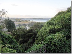
View from our deck in Rotorua.                       
1387 Maunganui Vista 2
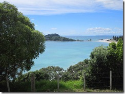
View from Mt. Maunganui.


From Rotorua, we headed toward Tongariro National Park by way of a warm-up day hike up Mt. Maunganui.  Tongariro is the oldest national park in New Zealand and a World Heritage Site. Much of the land within the park is sacred to the Maori, especially the peaks of the three active volcanoes: Ruapehu, Ngauruhoe, and Tongariro. We stayed in a tiny town at the edge of the park, imaginatively named National Park. The next day we found ourselves back on the trail, with TBone in tow, hiking the Tongariro Alpine Crossing. Billed as the most spectacular and challenging dayhike in the country, the crossing covers an alpine zone between Mts.Tongariro and Ngauruhoe. The landscape is truly eerie, almost lunar, with steam vents puffing out of the ground and hardened lavaflows descending from the peaks. One of the best parts is the signage—very detailed interpretive materials outlining proper behavior in case of volcanic activity. Helpful hints like “if you see the pyroclastic flow, move quickly downhill away from it.” Ummm…DUH. Actually, I’m fairly certain that if you can see the pyroclastic flow, you only have about three seconds to live. Another useful tidbit: “Do not approach or touch the flowing lava.” Well, only if you don’t value your extremities.
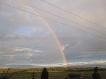
1398 Rainbow in National Park 1
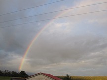
Rainbow side 1…
1399 Rainbow in National Park 2
Rainbow side 2…. National Park.

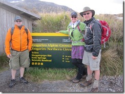
1402 Tongariro Departure
Prepared for departure, Tongariro Alpine Crossing.
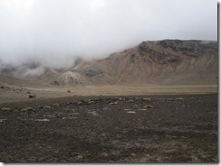
1416 Tongariro 9
Welcome to Mordor.
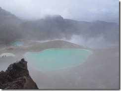
1421 CraterLakes4
Crater Lake, Tongariro. The color is due to the high mineral content.
I have to say I’m glad we did the Crossing, though it was disappointing in some ways. First, I wasn’t expecting there to be a humanity bomb detonation. There were busloads of people, including some sizable school groups, most of whom were spectacularly unprepared. Second, it was not that challenging. The hardest part was dealing with the steepest section of trail, surrounded by children and tourists, after the snow started. No, that’s not a typo. It’s called “Alpine Crossing” for a reason, folks. And that does mean you should bring some raingear. And not wear Keds or flipflops. And not carry a purse. I’m still amazed no one got flown off that mountain. Disappointments aside, perhaps the coolest part of all (here I will out myself as a huge, honking LotR geek)—this is Mount Doom!! This is hiking through Mordor! Way. Too. Cool.
Of course, it’s New Zealand, so the next day is just as amazing. From Tongariro, we drove north to Waitomo, a town famous for its caves and their inhabitants, the glowworms. I’ve done a good bit of caving, but neither Pancho nor TBone had. And Pancho, at least, is more than a little claustrophobic. So they were both a little apprehensive about the caving experience. We started with a 150ft rappel into a hole in some sheep field outside of town. Then came the zipline. In the dark. Which totally rocks. You have no idea where you’re going or how far it is, then BAM—you literally hit the end of the line. Next, we hopped into innertubes and jumped off a small cliff into a subterranean river.
We paddled along the dark water with clusters of tiny glowing dots overhead. The glowworms are technically phosphorescent maggots (fly larvae) that live in the caves. They dangle threads below themselves to catch insects for food. Then they morph into flies, have sex for 48-hours straight, lay a bunch of eggs, and die. Good times. The exit from the cave is almost as dramatic as the entrance—climbing up a waterfall, out into a stream, in the middle of another field. It was a great day, and even the claustrophobes loved it.

[Sadly, we have no pictures of the glowworms at the moment. Cameras are not allowed for safety reasons and the photodisc we bought from the tour is not reading on our computer. Hopefully in the future…]

From Waitomo, it was back to Auckland, for the next part of the adventure. We hooked up with another ATL buddy, Junior, then picked up a charter boat for a couple of days sailing in the Auckland area. We planned to head to Waiheke Island, a major wine area, to do a bit of tasting with our resident oenophile, TBone. The wind was pretty lively on the way out and as we were pulling into the harbor, one of the lines snapped and our headsail was loose. We managed to get it lashed onto the deck with plans to do repairs the following morning. Not being too worried, we took off to Cable Bay Winery, a stunning contemporary complex overlooking the water and the Auckland skyline in the distance. Fabulous wines and food.
1432 Pancho at the Helm
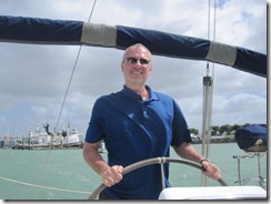
Pancho in his element.
1449 Cable Bay Vista 1
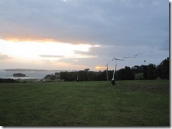
Cable Bay Winery, Waiheke Island, with moving sculptures.

Unfortunately, in the morning, we started getting calls and texts from various folks, suggesting we look at the forecast. As Pancho and I listened to the weather, we realized why. Gale warnings for the Hauraki gulf later that day. One guess as to our location and the gulf between us and Auckland. Worsening winds and seas. Yikes. Our plans were completely dashed when Pancho called the charter company and the guy said that in 20-some years, he had never encouraged anyone to come in early. But we did—motored back to Auckland with our crippled sail and parked in the marina that night. Where it was unbelievably rough and windy—I can’t imagine how it would have been at anchor off Waiheke.
It was par for the course on our New Zealand adventure, though. Things don’t always go according to plan and you just have to stay flexible and roll with the waves as they come.

Wednesday, March 14, 2012

100% Kiwi Adventure

As expected, there were some terrific events at the University, kicking off with a ride up the Skyline Gondola in Queenstown and dinner at a restaurant overlooking the city and lake. Just to get our appetites going, there was also street luging—riding down a course on the mountain on little luge carts. Awesome! Totally worth it to see a bunch of super-type-A entrepreneurs wearing helmets, giggling like little kids, and trying to ram each other.
1296 University Haka 1
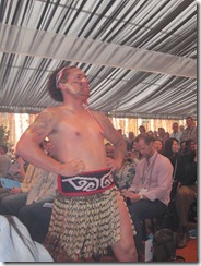
We were welcomed to the university in traditional Maori style, with a haka.
Our next outing was even better: boarding the TSS Earnslaw, crossing Lake Wakatipu to the Walter’s Peak sheep station, and enjoying a fabulous BBQ on the shore of the lake as the sun dropped behind the mountains. The Earnslaw, one of the last passenger steamships in operation in the world, was commissioned to deliver people and goods to the remote stations (ranches) around the lake, many of which remain inaccessible by road. The station is now open for tours, meals, agricultural demonstrations, and cycling tours. I highly recommend both the boat journey and the station, if you’re in the neighborhood.
1313 On Deck Earnslaw
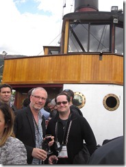
TBone and Pancho on board the Earnslaw, en route to Walter Peak.  


1240 QT Steamer 2
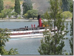
The TSS Earnslaw heading out of Queenstown harbor.
1323 Walter Peak Station
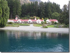
Walter Peak Station on Lake Wakatipu.
1324 Walter Peak Vista 1
The area surrounding Walter Peak.


We had another amazing experience on the Dart River, near the town of Glenorchy, where we rode in the jet boat upriver before “funyaking” back downriver. Jet boats are incredibly popular in New Zealand, where the jet boat engine was invented. They actually originated out of a practical need to transport supplies and sheep to inaccessible areas on extremely shallow rivers. Since the jet engine doesn’t use a propeller, it can function in around 4 inches of water. Now, of course, the boats serve a much less practical purpose, primarily whipping through canyons and river valleys filled with shrieking tourists, doing high-speed turns, and generally trying to scare the crap out of paying customers. Big fun. Though very cold the day we were out.
1340 Jet Boat 2
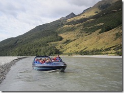
Jet boating on the Dart River. Notice how shallow the water is here.
1345 Dart Vista 3
View along the Dart River.
1352 Into Dart gorge
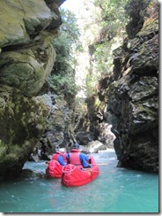
A side trip into a gorge along the Dart River.
1357 Nachita funyaks
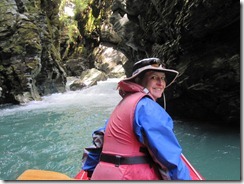
Paddling through the side gorge.


The jet boat dropped us up the Dart River valley where we hopped into our funyaks—inflatable, idiot-proof, and (almost) tip-proof kayaks. We paddled back down the river, through some very mild, maybe class 2 rapids. It was a glorious day, though. Sunny and warm, with a perfect view of absolutely stunning mountains, waterfalls, and creeks. During our lunch break, we paddled up a tiny gorge, almost completely closed off from above, something you would never find on your own.
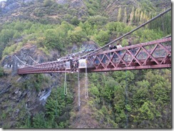
We finished off the University at the home of bungy jumping: AJ Hackett Bungy at Kawarau River. The Kawarau bridge was the first place anyone ever jumped and a number of EO folks—including TBone, Junior, and Pancho—took the plunge. When asked about the experience, all Pancho could say was “The split second my feet left the platform, all I could think of was:  WHAT HAVE I DONE!  There are no take-backs.”
1362 Kawarau Bungy
Bungy jumping set-up, Kawarau Bridge.
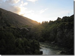
1361 Kawarau River valley
View of the Kawarau River.
1378 ATL Jumping Guys
The ATL bungy boys ride the post-jump high: TBone, Junior, and Pancho.

Thursday, February 23, 2012

Pining for the Fjords

We’re back in Queenstown for Entrepreneur’s Organization University, the “real” reason we’re in NZ, and we’ve seen some amazing things since our last post.
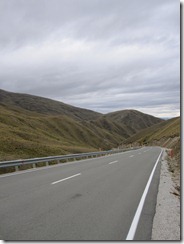
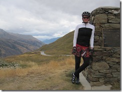
It was a tough trip to Queenstown from Wanaka. We went over the Crown Range, the highest paved road in NZ. Fortunately, we were going the easy direction. Though that still meant we had a 40 km climb, that got much steeper at the top. I had to get off and push for the last kilometer and Pancho for the last 500m. I was moving so slowly I was about to fall over, which on a super narrow road with no shoulder would surely mean getting run down by a campervan full of tourists. Of course, going up the easy side meant a screaming descent on the other side. You know it’s bad when you can smell your brakes burning out. We rewarded ourselves with lunch and cider in Arrowtown, an historic mining town on the outskirts of Queenstown.
1214 Up the Crown
The road we rode up...
1216 Top of the Crown
At the top of the Crown Range
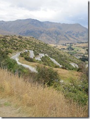
1220 Descent to Arrowtown
The road ahead. Check your brakes now!


We woke up in our tent in Queenstown to rain, cold, and unbelievably sore legs. This prompted a little conference regarding the cycling plan and led to the formulation of plan B.
We hopped on the bus to Te Anau, the gateway to Fiordland National Park, one of the most spectacular and remote areas in NZ. We had originally planned to cycle there, but then came plan B. It would have been two very long days on the bike, and our intel revealed that there would be a serious headwind for most of the way. Once we were on the bus, we were very pleased with plan B: the route was much hillier than we had thought and the even the bus struggled through the stiff winds. The only drawback for me was that we had planned to camp on an alpaca farm along the way, and I was weirdly excited about it. Fortunately, I made up for the wildlife viewing the next day.
Te Anau is a backpacker’s haven. It’s the starting point for several of the “Great Walks,” as they call some of the iconic hiking trails here, including the most famous of all, the Milford Track. (Trails are tracks; hiking is tramping) We felt right at home, with everyone walking around in boots, with packs and gear, either heading out or just coming in from the trail. There is also a big grocery store (not common in most of the smaller towns here) that is re-supply central.
Instead of hiking, on this trip we were on the water, going kayaking on Milford Sound, one of the most beautiful places in the country. The Fiordland NP has 16 sounds, with Milford being the only one accessible by road. There are a fair number of small cruise boats and tour boats there, but paddling is definitely the best way to see the sound. Technically, the sounds are all fjords, a sound being a river valley filled in by seawater and a fjord being a glacial valley. Apparently, the Kiwis compensated for the mistake by naming the Park properly, though they then misspelled it.
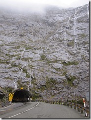
1254 Homer Tunnel 1
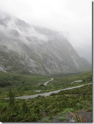
The Homer Tunnel, en route to
Milford Sound.
1256 Road from Homer Tunnel
The road down from the Homer Tunnel.


Nomenclature aside, the Sound is spectacular. We paddled through an area only accessible to kayaks at high tide that was like entering a primordial forest. There were branches hanging down across the water, covered with moss and orchids. Afterwards, we headed out into the Sound proper. The day started out rainy, which is a mixed blessing at Milford. The water was flat and perfect for paddling, But best of all, there were waterfalls everywhere. The Sound is surrounded by sheer mountains, and after rain, water pours down the rock faces, so there are streams of all sizes cascading down all around you.
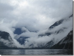
1261 Milford 4
Milford Sound.
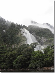
1263 Bolan Falls 2
Bowen Falls, the largest permanent
waterfall at Milford Sound.
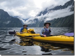
1277 Pancho and Nachita Paddle 2
Pancho and Nachita on the water.
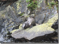
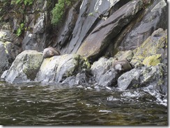
I also got in my wildlife quota to make up for missing the alpacas. Lots of young male seals live in the Sound, before they’re able to compete for the females in the colonies out on the coast. In the kayaks, we were able to get really close and just sit watching them. Now, we also know that there are animals lazier than our cats.
1265 Milford Seal 2
Milford seal.
1273 Milford Seal 10
Lazy beasts.


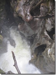
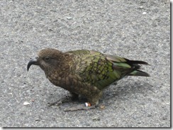
We had another wildlife encounter on the ride back to Te Anau—with the notorious kea, the naughty parrot of the South Island. We stopped at The Chasm, a river channel with amazing rock formations, and found a kea patrolling the parking lot, looking for snacks or cars to eat. Apparently, rental car agreements here contain a clause denying responsibility for kea damage. Yikes!
1290 Into the Chasm
Looking down into the Chasm. Off
the Milford Road.
1282 Kea 4
Naughty parrot.
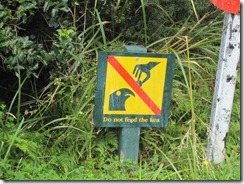
1284 Kea Warning 2
Don't feed the kea if you want to keep
your finger.


Now we’re happily ensconced at the hotel in Queenstown—it’s been raining all night and day, so we’re very happy to not be in the tent. There are some great events planned, and we will be braving the rain this afternoon for a ride on the Shotover Jet Boat. Keep following along!

Saturday, February 18, 2012

A Stiff Shot of Reality

Today, we admitted we bit off a bit more than we could chew on the cycling portion of our trip. It is exactly like our first week on the AT—we way over-estimated our miles. Not to mention the fact that here, there is so much to see, a photo-op around every curve, and pushing big miles every day doesn’t allow for many stops. We’re behind schedule already, since we only made it to Franz Josef today. So we’re hopping a bus tomorrow, heading for Wanaka, and a long, hilly ride into Queenstown on Saturday.
1180 Poerua River near HariHari
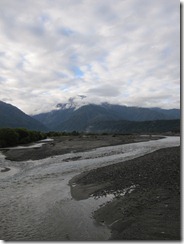
Poerua River, south of Hari Hari.
1185 Lake Wahapo
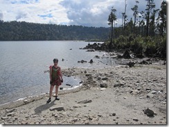
On the shore of Lake Wahapo, between Hari Hari and Franz Josef.
The ride today was spectacular, going through rainforest on the way to a glacier. It’s amazing how steep and heavily forested the mountains are. We rode through corridors of rainforest today (a return to the green tunnel), with towering trees covered with hanging bromeliads and steep slopes with gigantic ferns cascading down them. Then we would cross a broad, rocky riverbed, with a stream clearly coming down from the glacier. Now, we’re in the village of Franz Josef (disturbingly like a Kiwi-scale Gatlinburg), with the glacier hovering above us and rainforest all around. Surreal.
1189 Franz 1
Approaching the Franz Josef Glacier.
Fortunately, the scenery was astounding, because we moved into more hills today. I have to admit—we got our asses kicked today. It was just one of those days when we both felt totally out of gas, which is not good when you’re going over Mt. Hercules. On the plus side, we were at least traveling in the easy direction. But still. There were rest stops, There was bitching and moaning. There was Pancho shouting at me to leave him and save myself. Not our best day. So we’ll take tomorrow off, do some laundry, rest our legs, and start strong on Saturday. We’ll check in again when we get to Queenstown.

Tuesday, February 14, 2012

On the Road Again….

Saturday afternoon, we headed out on our next adventure—three action-packed weeks in New Zealand. Technically, we’re going to the Entrepreneur’s Organization conference in Queenstown, but that’s really only an excuse.
I was really dreading the flight: 5 hours to LAX, then 12+ to Auckland, then another short hop to Christchurch on the South Island. It turned out to be better than expected, but still a terribly long couple of days. One highlight of the trip was the Air New Zealand safety video. Now, we have long been fans of the Delta video, watching attentively while our friend Frank demonstrates proper seatbelt technique and Deltalina works her dominatrix mojo to stop smoking on-board. But I have to admit, Air New Zealand wins hands-down for the most wondrously wacky safety video. They have smoking hot All Blacks. They have body paint (consider yourself lucky, Frank!). But most importantly, they have Richard Simmons, in all his spastic, thinning afro, inappropriately short shorts, glory. Richard Simmons—epic!
We finally arrived in Christchurch and picked up our rental bikes and touring gear. After quickly reorganizing our enormous amounts of stuff, we set out for our B and B, in the central city. Of course, that was more adventurous than expected, since we were riding on the other side of the road and with loaded bikes for the first time. We made it without incident to the lovely Orari B and B. It was actually challenging to find lodging in Christchurch, since so many properties in the central city were destroyed or severely damaged by the earthquakes in 2010 and 2011. There is still a large section of the city cordoned off and inaccessible due to the instability of the buildings. We saw a number of beautiful, historic structures that have been irreparably damaged or will take years to repair. We didn’t see that much in Christchurch—we walked around the city center for a bit, then through the Botanical Gardens, which are truly spectacular. Unfortunately, we were too tired from the trip to really enjoy the city.
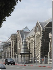
1066 ChrCh Turret
Turret in Christchuch earthquake zone.
1077 ChrCh Conservatory Pancho
Christchurch Botanical Gardens Conservatory.
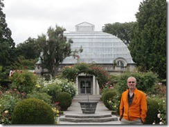
Currently closed due to earthquake damage.
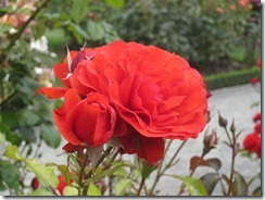
1078 ChrCh Rose
Christchurch Botanical Gardens.
The following morning, we set out in the rain to the train station to catch the Tranzscenic Alpine train across the South Island to Greymouth. This is considered one of the most spectacular train trips in the world. Unfortunately for us, it was a dreary, rainy day, so many of the mountains were obscured by clouds. It was still pretty spectacular, though, and I would highly recommend the journey. 
1115 Tranzalpine 18
View from the Tranzalpine Train from
Christchurch to Greymouth.
1117 Tranzalpine 20
View from the Tranzalpine Train from
Christchurch to Greymouth.
1131 Tranzalpine Viaduct 4
Viaduct on the Tranzalpine route between
Christchurch and Greymouth.
Once we arrived in Greymouth, it was time to hop on the bikes and head south to Queenstown. Fortunately, we started with an easy, flat, 40km pedal to Hokitika. For much of the ride, we were going along the coastline, watching the surf crash into the beach. We’re planning to camp for the biking section of the trip, so we headed to the Hokitika Holiday Park.
1163 Going to Hokitika
Coastal view between Greymouth and Hokitika.
1164 Hokitika Break
Taking a break en route to Hokitika.
1167 Hokitika Sign
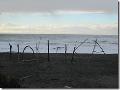
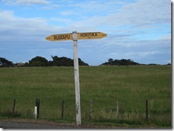
Hokitika beach sign.
It’s in many ways like being out on the trail again. There are loads of other cyclists touring here, and it’s great to meet other folks. Unfortunately, it’s also far too like the beginning of the hike. We feel like we’re starting over in so many ways—figuring out our systems, organizing our gear, adjusting to a very different physical activity. Today, we were supposed to go 134km to Franz Josef, one of the large glaciers here on the South Island. We didn’t quite make it, instead pulling up early in Hari Hari. We have a lot of pains today. Legs, butts, backs, you name it, it hurts. So now, we’re behind schedule, but we’ll figure something out. Happily, there is bus service all along our route to Queenstown, and we may have to avail ourselves of it. For the moment, we’re enjoying some local cider in the pub at the Hari Hari Motor Inn and I’m sure it will be an early evening. Much like the AT, 6:30PM is a perfectly acceptable time to go to bed.
1176 Road Sign
En route to Hari Hari.
1177 Pancho in Motion
Pancho on the move.