Monday, May 23, 2011

Where is the *%&$^# shelter?!?

After our down time in bustling Buena Vista, we returned to the trail invigorated and about 20 pounds lighter, resulting in our longest hiking day yet--about 14.5 miles. On the whole, it was an odd, slightly eerie day, since we saw only a couple of other hikers on the trail. We ended up camping down in a hollow at Porter's Field, next to a spring, all by ourselves. Given the often crowded and always social nature of the AT, this was pretty unusual, though not unwelcome. We did have an early morning wake-up call, when two owls had a rather raucous throwdown, apparently directly over our tent.
The next morning we headed into the Priest wilderness, climbing the eponymous peak, then suffering through the over three-mile descent. Three miles of rocky, precarious (ie., too steep for switchbacks) descent, which don't mesh well with knees full of metal. A long, painful day for both of us. We finally rolled into Harper's Creek, a beautiful area, with unfortunately rocky and less-than-flat tentsites, asking the usual end-of-day question: where is the *&%^#$ shelter? It's amazing how long that last .3, .2, .1 mile can take when you're exhausted and frustrated and hungry.
As is so often the case on the AT, one tough day follows another. We started the next morning with the steepest, longest climb so far, up the Three Ridges. The worst part was the fact that it mainly involved scrambling over rocks and boulders, in addition to the steep terrain. After a couple of long, difficult days, neither of us were feeling it. We had hoped to make 21 miles--by far our longest hike--to the Wolfe shelter. This would put us a short 6 miles out of Waynesboro, our next scheduled stop. By noon, we knew that 21 miles? Not happening. As I trudged along, I recalled the sage advice of Swift, our drinking buddy in Buena Vista, who advocated making your miles however you could, even if it meant backtracking or slackpacking.
So we pulled out the map, found a spot where the trail crossed the Blue Ridge Parkway 14 miles from Waynesboro--a more manageable distance for us--and made a decision. We planned to hitch a ride into town, find a hotel, hit the AYCE Chinese buffet (interestingly populated only by thru-hikers and incredibly fat people), then hitch back to the same point the next morning and finish our miles into town. Leaving our packs in town, carrying only daypacks (slackpacking).
When I popped up onto the Parkway, I dropped my pack, looked around, and saw a couple of dayhikers heading my way. And so came our first instance of "trail magic." When I asked if they were perhaps headed to Waynesboro and might be able to fit in two more, they said yes--and they happened to be in charge of the hiker hostel in the local Lutheran church. It turned out to be the only game in town--graduations had all of the other hotels booked. But we had a clean, quiet place to sleep with 20 other thru-hikers in their fellowship hall, all for an optional donation. You learn quickly that there are a lot of amazingly nice and generous folks helping you make this journey.
We've also concluded that slackpacking ROCKS, and we have no shame about doing it whenever we get the chance. There are some pretty hardcore hikers out here--"purists"--pushing 25-35 miles a day, who would scoff at such a thing. But one of the major tenets of the AT is "hike your own hike." And fortunately, neither of us care too much about what anyone else out here thinks.
We decided to take another zero day here in Waynesboro--not scheduled, but ultimately a good idea. I had developed a nasty hacking chest cough and we're about to head into Shenandoah National Park, which will take us at least 9 days to get through. We thought it would be wise to take a rest day, since we need to up our miles, and I've been able to shake the worst of the cough. It's also amazing how much stuff there is to do when you hit town, beyond showering and eating. Our funny moment today was the post office lady telling us we couldn't have been on the trail too long, because we looked too clean. Apparently, most hikers come to the post office prior to showering , so she was quite appreciative of our clean outfits and not-so-noxious odor.
Especially for my preservation peeps: some shots of buildings
 in metropolitan Buena Vista....

Southern Virginia University (cupola in the background)


Buena Vista storefronts

Climbing the Priest, before the nasty descent sucked the smile right out of me.

Pancho, heading across the bald. This was a really different environment
 than what we had seen so far, with rolling, grassy pastures

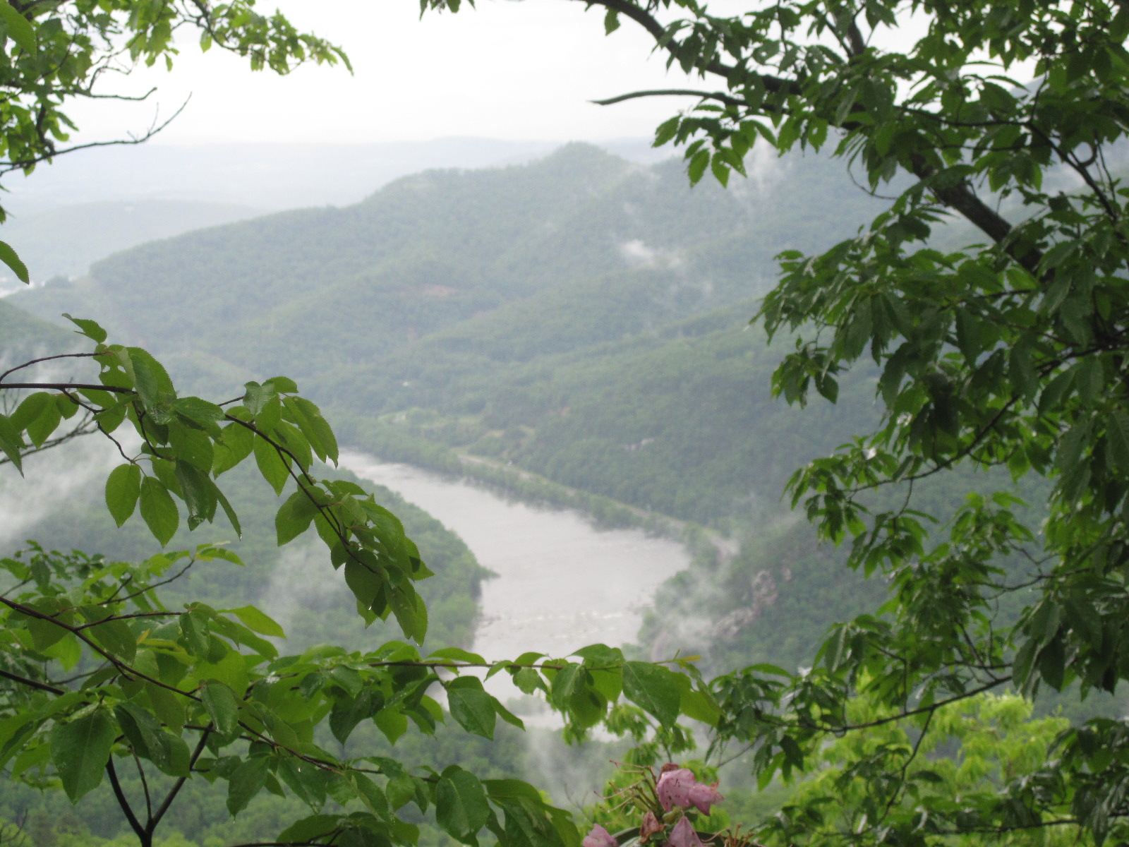
The view across the bald.

Funky tree growing out of the rock.

Pancho on the trail.

Our home alone in Porter's Field.

Pancho in gnat evasion mode in Porter's Field.

Wild honeysuckle.

Taking a breather on the Three Ridges climb.

Tye River suspension bridge (VA).
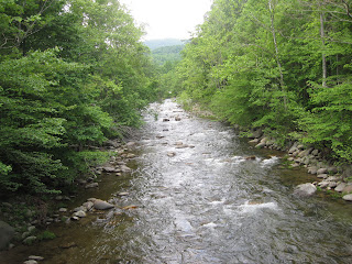
Tye River (VA).

Water bottle along the trail--not sure if this was an intentional discard or not.
For those who have read Bill Bryson: Katz was here!

Approaching Waynesboro, VA.

Two thru-hikers + one hotel room = entropy.

Wednesday, May 18, 2011

Does anyone have any sunscreen?

Because we have yet to see the sun, hiking through the great Virginia rainforest. Days two and three were periodically soggy, while day four was downright sodden. My hair basically never dried after my hotel shower in Rocky Mount. Not to mention our clothes.
Hiking has improved daily--we doubled our miles on the second day, camping at Johns Hollow, then a slightly shorter third day, with a pretty strenuous climb into Punchbowl shelter. Then came yesterday. Ugh. A terribly typical day on the AT. Meaning torrential rain for extended periods. I have only ever been that wet in a bathing or swimming scenario. Soaked to the skin, covered in mud, and not warm. But we busted out 11 miles, with Eric having his best hiking day so far, even though we were both pretty dejected.
I never thought I would be so glad to see the Budget Inn in Buena Vista, VA. Or to place that call to Domino's and have someone bring hot pizza to my door. Very simple things become very important out here.
We've been hiking along much of the way with two guys--Sprawl and Overload. Most AT hikers go by a trail name, either one they choose or one given by other hikers. In this case, Sprawl has a tendency to spread gear all over the shelter. And Overload came to the trail with way more than he could carry.
Which brings us to our blog address and our trail names--Pancho and Nachita. Some of you are already giving a wink and a nudge (you know who you are :)). Back in April, we attended the lovely wedding of Todd and Silvana in Buenos Aires, then headed out with a small, hearty band to the wine country in Mendoza. After a long, slightly boozy lunch, the decision was made to give everyone a Spanish nickname. Eric was dubbed Pancho Two Balls, following Johnny One Ball (Juan una bolla). We decided someone had to be Nacho, and since all the guys already had names, I ended up as Nachita, which we translated (incorrectly, I'm pretty sure) as "little tortilla chip." So we concluded that those would be our trail names. Which is almost certainly better than waiting for other hikers to pick something for us.
We stayed in town today, doing some errands, mailing some stuff home, drinking some beer. Overload lived up to his name today. He arrived in town completely out of food and headed straight to the grocery store. I really have to question some of his choices. Plain pasta, dry oatmeal, and a 2 pound bag of brown sugar, which he rationalized as being cheaper than candy. Huh? We gave him a bunch of trail mix and sent him on his way. Then spent the afternoon drinking beer with Swift, a retiree from Maine on his third thru-hike in as many years. Also a sailor, so we hope we'll see him again along the way. He's got Eric all excited about the all-you-can-eat Chinese buffet in Waynesboro, our next stop.
Time to get some sleep, before our ride back to the trailhead at 6:30 tomorrow morning.
Heading toward the James River Footbridge, the longest
footbridge on the AT.

A view of the James River, during a break in the rain.

Looking across the footbridge.

Looking back where we came from, at the James River.

Which way do we go? Stick to the left.

Crossing Brown Mountain Creek. This is a really beautiful creek that we followed for miles.
 In the late nineteenth century, a community of freed slaves lived along this creek.
Blogging at the Buena Vista Budget Inn, in the thru-hiker ghetto.


Well, we're still working on the GPS track. Below are days 2-4, slogging through the rain. The distances are a little off, as the starting and ending points are off, but the total distance for the three days is just under 35 miles.


Finally!

On Saturday, May 14, we finally started hiking from Thunder Ridge Overlook, along the Blue Ridge Parkway in Virginia. Just driving to the trailhead was pretty harrowing, through pea-soup fog, with no visibility. But my mom got us there, and we geared up in the overlook parking lot with a boy scout troop from Roanoke.
We went along with the scouts for a few miles, saw some funky salamanders, and loads of wildflowers, but little else, since the fog hung around all day.
Our starting point on the Blue Ridge Parkway.
Alas, we are not taking the 10 minute loop.

Ready to hike!

Thunder Ridge Overlook. The white blaze is the marking for the AT.

Taking off into the mist.

On the trail, day 1.

The view is pretty awesome, once the fog clears.

Trail buddy. I came really close to stepping on him....

Self Portrait
We had hoped to go 11 miles, but ended up with about half that, camping at Marble Spring. We know we need to take it easy at the beginning, especially since we both have a tendency to go hard early. Pouring rain, thunder and lightning all night--just a taste of what's to come.

Although our progress has been slow.  Below is our first day's GPS track.  We are still trying to figure out how to work the GPS, but this is a starting point.  We hope to include one of these with every post.

Friday, May 13, 2011

The AT for the Uninitiated

So for all y'all who are unfamiliar with the Appalachian Trail and long-distance backpacking, here comes some background.
The AT is one of the 3 major "long trails" in the States, along with the Pacific Crest Trail (PCT) and Continental Divide Trail (CDT). Hiking the entirety of all 3 constitutes the Triple Crown of backpacking. Of the 3, the AT is by far the most heavily used, best known, and well marked.
The AT runs from Springer Mountain, in north Georgia near Amicalola Falls, to Mount Katahdin, located in Baxter State Park in Maine--a total of about 2200 miles. ( I say about because the trail often has to be re-routed for a variety of reasons. The violent storms we've had in north Georgia this spring have already taken a toll.) The PCT stretches 2600 miles from Mexico to Canada, through California, Oregon, and Washington. The CDT also goes border-to-border, covering 3100 miles through Montana, Idaho, Wyoming, Colorado, and New Mexico.
Several thousand hikers set out to thru-hike the trail each year, but only a quarter complete the entire distance. Most travel northbound, leaving Georgia in the late spring, reaching Katahdin in September or early October. We are "flip-flopping," starting in the middle, heading north, then returning to our start point and heading south.
There are shelters located along the length of the trail--partially enclosed structures, mostly constructed by the CCC where hikers can sleep. We're carrying a tent and plan to camp whenever possible, having heard from many other hikers that the shelters tend to be noisy, crowded, and often chock-full of rodents.
Food is obviously a major concern. We made and dehydrated most of our own over the last 4-5 months. Though there are lots of places to resupply along the trail, we opted to use maildrops. So my folks are the supply-masters back in Atlanta, shipping us boxes of food at prescribed intervals to post offices in towns along the way. Many thru-hikers subsist on ramen noodles, snickers and oatmeal, but we're hoping to have a lot more variety and some more nutritious fare. Honestly, I ate enough ramen in college, I do not need to revisit that diet plan.
Time to head to Applebee's for the farewell dinner. Maybe more info this evening.

Hitting the Trail...

tomorrow morning. Finally. We hit a few logistical snags this week and had to push our departure back. Fortunately, my parents were incredibly (and for my mother, unusually) flexible about the numerous last-minute delays. Now, we're ensconced in the delightful Comfort Inn in Rocky Mount, VA. I can't quite recommend the accommodations, but we snagged literally the last two hotel rooms in south-central VA, since this is graduation weekend at every college within 150 miles. Eric & I seem to be making a habit of this, also scoring the very last room in Billings last summer, at the dubiously decorated Dude Rancher Inn. The decorating here is pretty mundane, though there are some dubious smells in the hall....
Sadly, we'll be having our last meal at Applebee's, since that is apparently the only option in the Rocky Mount metropolitan area. Though I'm fairly certain that in a couple of weeks, Applebee's will be sounding pretty damn tasty.
I'm going to try to do another post later this evening. Growing up in the southeast and doing lots of outdoors stuff, I've just always been aware of the AT and have known several people who have hiked it. But I've come to realize that many folks don't really know what we're doing (and many of those that do question our sanity). So I'm planning to do a little AT primer: a little background on the trail itself and some  of the logistics involved in hiking the whole shebang.
For now, I'm going to kick back in air-conditioned comfort, drink a Strongbow, and maybe avail myself of the indoor plumbing while I still can. Later. :)

Monday, May 9, 2011

T-48 and counting....

So, we have around 48 hours until we head out to VA to start hiking, and I've officially moved from despair to mania. We still have so many little things to take care of before leaving.
Today was a big day, though. Today was hair cut day. After quite a few years with long hair--which was longer than it ever had been--I was shorn this afternoon. Now, I have a much more trail-friendly 'do and a ziploc full of hair. Two pretty sizable ponytails are off to Locks of Love tomorrow. (For those who don't know, they use donated hair to make wigs for cancer patients. Awesome group.)
And because there have been many requests, here are a few before and after pix with Dana Walker, fabulous hair diva.
Before...

during...

and after. Thanks, Dana!

Thursday, May 5, 2011

Shakin' it down

Just rolled in from the mountains and a little shake down hike. This also marked Eric's first backpacking experience. No, that is not a typo. He goes big or not at all. So we spent a rather chilly night by Martin Creek on the Bartram Trail. Played with the new GPS and hoping to link it up so we can post our position as we go.
It is a bit scary that when asked when we head out, the answer is no longer "Oh...in a few weeks." It's now "Wednesday." Yikes.
Eric on the Bartram Trail near Clayton, GA

Our little domicile for the next 6 months


Chilling at the end of the day

Sunday, May 1, 2011

Work in Progress

Last week, I was definitely feeling a touch of despair. Feeling like the list of things still to do was just not possible within the increasingly short amount of time before we head out.... But we made lots of progress this weekend, thanks to help from Jim and The Wiz. We have our boxes assembled and mostly filled for our maildrops, and the items that need to stay in the freezer all labeled and bagged together.
I'm still amazed by what an incredibly involved process this is, organizing 6 months worth of food in advance.
This is what happens when a Costco goes "boom" in your house

The Wiz bagging trail mix and decorating the bags with delightful stick figures


Eric, Jim, and I sorting our dehydrated meals in the garage command center